
Friday Weather Update: Strong to severe storms with gusty wind possible again this afternoon.
- Jeffery Kolling Jr.

- May 4, 2018
- 1 min read
Unsettled weather will continue today across east-central Ohio as low pressure drags a cold front through the region later this afternoon.
The NWS Storm Prediction Center has our region highlighted in the Slight Risk (2/5) for severe storms today.

The primary threat will be damaging wind gusts. Small hail is also possible. The threat of tornadoes is low but an isolated tornado can’t be completely ruled out. Storms that accompany today’s front will be fast-movers so the threat for flash flooding is low.

The limiting factor for strong thunderstorm development will be how unstable the atmosphere can become. Less sun will lead to less daytime heating and lower instability.
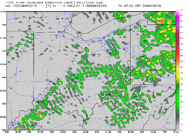
TIMING While I can’s rule out a stray thunderstorm or shower anytime today, guidance from the hi-res model shows the strongest thunderstorms will likely roll through between 3:00 PM and 6:00 PM.
Futurecast radar for today from the hi-res short-term model:
The warm and muggy summer-like conditions this morning and this afternoon will become much more pleasant this evening as cooler drier air moves in behind the front.


Comments